Sabine Sandbar Paddling Trail
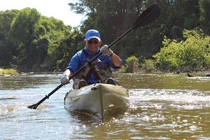
Enjoy quiet pools, small riffles, and great fishing for up to a full day's paddle on your choice of 4, 15, or 19 miles of trail.
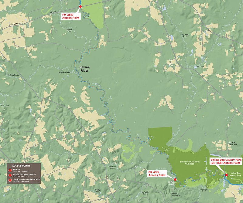
Trail Access
FM 2517 Public Boat Ramp
- Type:
- Put In
- GPS Coordinates:
- 32.1256, -94.2022
From Carthage, head southeast on US Hwy 59. About one mile past Loop 149, turn east off Hwy 59 onto FM 2517 and continue for 4.5 miles to the public boat ramp (on the north-east side of the bridge crossing the Sabine River).
CR 438 (McFadden Park)
- Type:
- Take Out
- GPS Coordinates:
- 32.0026, -94.1323
For a bit shorter paddle, there is an alternate take-out on the west side of the Sabine River at McFadden Landing. From Carthage or from where FM 699 crosses FM 2517, head south on FM 699 and then east on CR 430 to CR 432. Turn onto CR 438 which dead ends at the public boat ramp named McFadden Landing.
Yellow Dog County Park, CR 455
- Type:
- Take Out
- GPS Coordinates:
- 32.0043, -94.0922
From the Put-in location go east on FM 2517 across the Sabine River to Hwy. 31. Go south on Hwy. 31 to CR 455. At the end of CR 455 on the west side of the Sabine River will be Yellow Dog County Park, the main trail take-out.
Navigating the Trail
Trail Length:
FM2517 to CR 438 (McFadden Landing): 15 miles
FM2517 to Yellow Dog/CR455: 19 miles
CR438 (McFadden Landing) to Yellow Dog/CR455: 4 miles
Float Time: 2-10 hours (depending on water level, flow rate, and wind speed)
Please note: The 15-19 mile long portions of this trail will take 7-10 hours, so pack and plan accordingly.
Trail Description
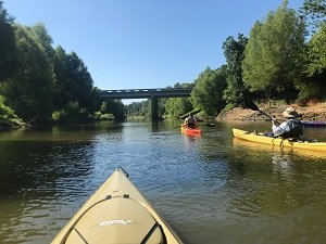
A variety of water types including quiet pools and several small riffles are present. Although there are no man-made obstructions on this reach, there may be snags to avoid, especially when water levels are low. Heavy rains and high water can create dangerous conditions as the river levels vary greatly with weather situations. Floating trees may be encountered but log jams on this section of the Sabine River are rare.
The Sabine River is a natural river that is restrained by a flood control and hydroelectric dam downstream from this paddling trail. As such, this river is readily influenced by rainfall runoff that may create temporary high flows and undesirable water quality conditions. Flow and water quality information is available to paddlers at Texas River Guide/Stream and River Flow Gages.
Private Property
Respect private property by not trespassing or littering and keeping noise levels down. This river is classified as navigable, which permits public use of the streambed and, if necessary, the banks to portage any hazard. Any other use of private river banks without permission of the landowner can be considered trespassing. Under Texas Penal Code (§30.05), criminal trespass occurs when one enters property after receiving notice not to enter. Notice includes verbal notice, a fence, sign(s), purple paint on posts or trees, or the visible presence of crops grown for human consumption.
Trail Map
Things to Do and See
Fishing and Wildlife
Paddling allows you the opportunity to observe birds and other wildlife, such as herons, kingfishers, otters, deer, hogs, turkey, and the occasional Bald Eagle, in their natural habitat. Hardwood bottomland with species of oak, elm and ash along with pine trees grow along the river. Alligators may be present in this area. Remember to keep a safe distance between you and wildlife.
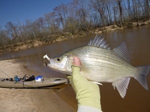
This section of the river supports numerous species of fish with the most common being catfish, alligator gar, and sand bass. The sand bass spawning run is an exciting annual fishing event from February to April. Small lures such as jigs, plastic worms, spinner baits and light-line are generally recommended.
Rentals and Shuttles
Austin Canoe and Kayak
Rent kayaks, canoes, and standup paddleboards by the day to take anywhere you want, when you want. Locations in Austin, Houston and the San Marcos/New Braunfels area. For more information, visit http://www.austinkayak.com/rentals
Partnership
This trail was made possible through a partnership between the Texas Parks and Wildlife Department, Panola County Chamber of Commerce, and the Texas Conservation Alliance.